


ScreenShots:


Software Description:
The Geographic Calculator is THE GlobalCoordinate Transformation tool for any coordinate or geomaticchallenge. This highly accurate transformation software includestools such as Canadian DLS (Dominion Land Survey) Land Grid tools,Seismic Survey Conversion tools, Area of Use tools for guidingusers, and much more. The Geographic Calculator supports a widerange of file formats with support from the largest geodeticparameter database available anywhere. When transformations have tobe correct, consistent and certifiable, GIS professionals aroundthe world choose the Geographic Calculator.
Since 1993, The Geographic Calculator has been the coordinateconversion tool of choice for GIS and survey professionals aroundthe world. The Geographic Calculator quickly grew in popularityover that first decade and has maintained its reputation as thebest coordinate conversion solution on the market. The GeographicCalculator has come a long way since then with many improvementsover the years. In 2004, the underlying GeoCalc library wasre-written and in 2007 a new version was released as the BlueMarble Desktop.
2013 saw a rebranding of the Blue Marble Desktop to the GeographicCalculator. Blue Marble incorporated all of the functionality ofthe desktop including the Geographic Transformer, Translator andSpatial Connect products into the Geographic Calculator. This didaway with the confusing versioning and introduced aneasier-to-follow annual naming convention with one or two servicepack updates between releases.
Today the tool provides a single platform for highly accuratecoordinate transformation of virtually any type of geospatial dataand includes features such as:
– Support for Windows 10 machines and improved installationprocess
– XML based coordinate object library
– Project Manager for data processing, jobs, and workflowmanagement
– Start Page offering a user-friendly introduction to the keyfeatures and functions
– Administrative Tools to customize the datasource and restrictediting access
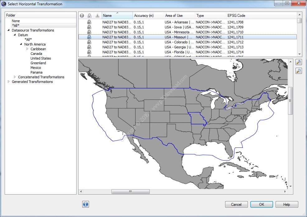
– Unmatched Geoid or Vertical Datum support, including VDatumsupport
– Powerful Survey Seismic format support
– Raster Geo-referencing, Reprojecting, and Vector File TranslationTools
– The ability to customize and send all or part of your GeoCalcdatasource to Global Mapper
– Esri Extension and powerful CAD support
The all-in-one interface of the Geographic Calculator enables usersto complete a number of geodetic and geospatial transformationfunctions on various types of data in the same interface withunmatched accuracy and accountability. The enterprise collaborationtools such as workspaces and network folders enable consistency andrepeatability of highly accurate data translation across yourorganization.
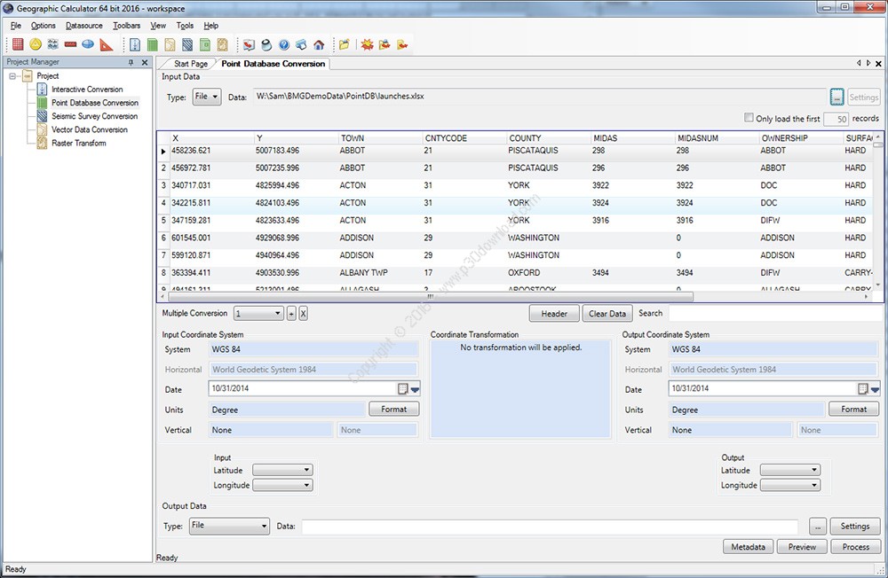
The 2016 version introduces a completely redesigned interface tostreamline workflow and to provide easy access to the importantcomponents of the application. For new users, a consolidated StartPage provides clear and concise explanations for each type ofcalculation and serves as a launching pad for easy access to thevarious jobs. Reorganized menus and updated toolbar buttons havebeen implemented to facilitate efficient data processing. The PointDatabase Conversion job has been split into five logicalcomponents: Conversion; Forward/Inverse Calculation; Scale andTranslate; Best Fit; and Derive Datum Shift. This simplifiedapproach provides a unique and intuitive interface for each type ofcalculation. Under the hood, the 2016 version incorporates the EPSG8.8 into the datasource to ensure the most up-to-date and accurateconversion and transformation results.
Here are some key features of “GeographicCalculator”:
– Interactive Conversion
– Point Database – Conversion
– Point Database – Forward & Inverse
– Point Database – Scale & Translate
– Point Database – Best Fit
– Point Database – Derive Datum Shift
– Seismic Survey Conversion
– Vector Data Conversion
– Land Survey Summary
– Raster Format Support
– Georeferencing – Reference Point Selection
– Raster Reprojection
– XML based coordinate object library
– Project Manager for data processing, jobs, and workflowmanagement
– Start Page offering a user-friendly introduction to the keyfeatures and functions
– Administrative Tools to customize the datasource and restrictediting access
– Unmatched Geoid or Vertical Datum support, including VDatumsupport
– Powerful Survey Seismic format support
– Raster Geo-referencing, Reprojecting, and Vector File TranslationTools
– The ability to customize and send all or part of your GeoCalcdatasource to Global Mapper
– Esri Extension and powerful CAD support
Installer Size: 182 + 236 MB
Download Links > Geographic Calculator 2016 x86/x64 + Crack