


ScreenShots:

Software Description:
Achieve efficient, centralized data management and powerfulmulti-project reporting with gINT ProfessionalPlus. Report and manage subsurface data in almost any waywith custom reports including graphics, photos, charts, maps, andmore. You can manage borehole, well logs, CPT, geophysical logs,and more for multiple projects. Automate repetitive tasks,eliminate redundant data entry, and dramatically increaseproductivity with gINT Professional Plus.
Capabilities:
– Create and visualize geotechnical reports
Virtually create any type of subsurface report – including boreholeand well logs, fence diagrams, cross sections/profiles, site maps,graphs, and tables – all from the same data. Standardize reportswith advanced report design tools for conditional formatting, datamanipulation, and decision making.
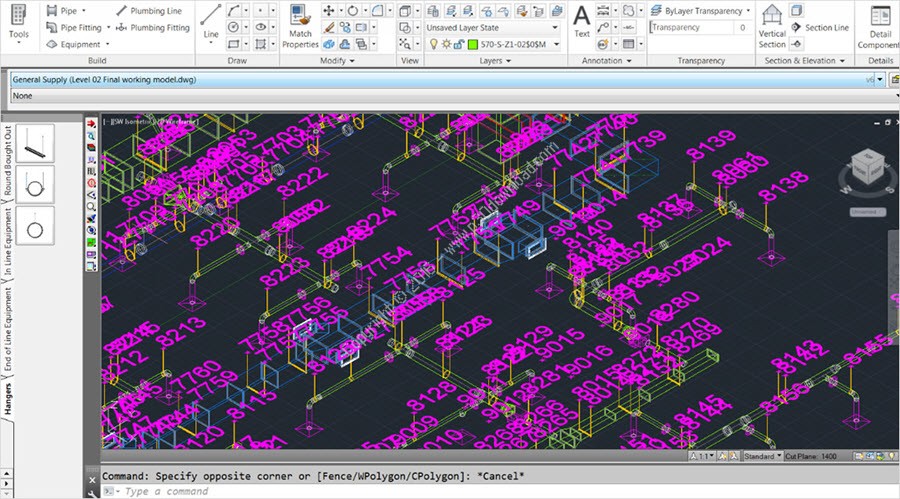
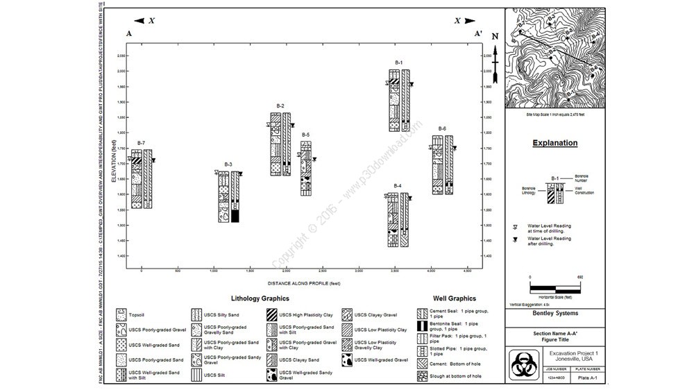
– Create fence diagrams
Display data from various boring logs in a single report with 2D/3Dfence diagrams. Use smart fence diagrams to adjust to the presenceor absence of data. Extract surface data, convert to a grid andthen display on fence diagrams. Depict features in elevation onyour fence report with graphics.
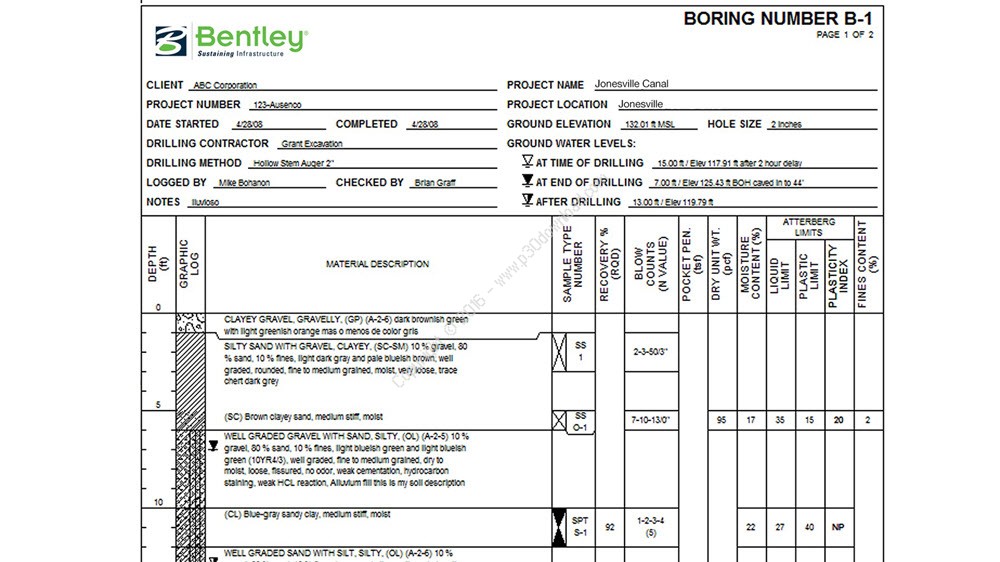
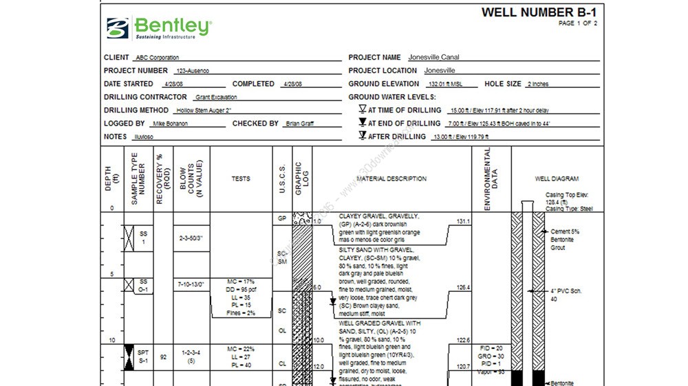
– Create geotechnical borehole logs
Jump-start with log reports provided with gINT installation, ordesign log reports to match your organization’s conventional paperlogs. Add intelligence and data-sensitivity to your log reportswith a rich set of log report properties and embeddedexpressions.
– Create geotechnical well logs
Customize your well logs with ease. Plot basic wells and complexwell lithology diagrams, lab and field tests, geologicalinformation, or any other required data. Create smart reports thatdisplay columns when specified data is available.
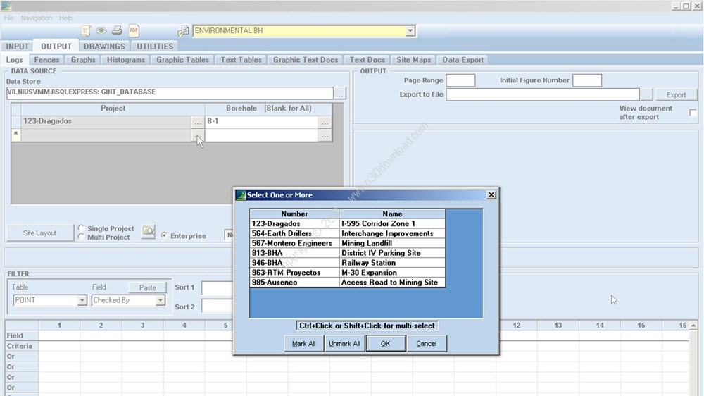
– Create multi-project reports
Report and query subsurface data from an unlimited number ofprojects with Microsoft SQL Server support. Standardize companymethods for entering, importing, storing, and reporting data forconsistency throughout projects. Convert projects so that they alluse the same geo-coordinate system.
– Interoperate with engineering applications
Save data in a non-proprietary format readily available for reuseby subsurface data consumers such as civil engineers,structural/bridge engineers, and geotechnical engineers for theirdesigns. Import and export data via customary formats such asExcel, CSV, Microsoft Access, AGS, LandXML.
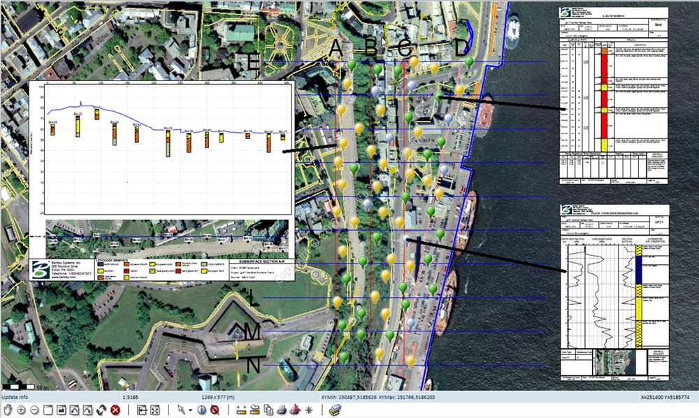
– Manage subsurface data
Use subsurface data management tools for data acquisition,validation, queries, reporting, and data sharing among stakeholderson a project level. Geotechnical, geoenvironmental, geology, andmining professionals can use subsurface data via a user-friendlyinterface.
– Manage subsurface data on multiple projects
Centralize multiple projects in an enterprise database to supportglobal collaboration. Use subsurface data management tools for dataacquisition, validation, queries, reporting, and data sharing amongstakeholders. Perform coordinate conversion between variouscoordinate systems.
Installer Size: 324 MB
Download Links > Bentley gINT CONNECT Edition Professional Plus v10.00.00.17 + AGS Toolkit + Crack