


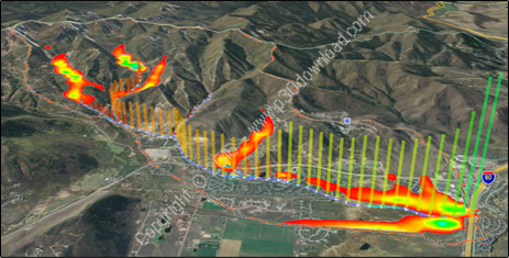
ScreenShots:

Software Description:
WMS is developed by Aquaveo, an engineeringservices company with many years of experience developing watershedmodeling solutions. Harness the entire spectrum of watershedanalysis tools with WMS – the all-in-one hydrologic and hydraulicsolution.
The complete all-in-one watershed solution:
– GIS Tools
– Web-based data acquisition tools
– Terrain data import and editing tools
– Automated watershed delineation & hydrologic modeling
– Support for the most industry standard hydrologic models
– Step-by-step hydrologic modeling wizard
– Hydraulic modeling & floodplain mapping
– Storm drain modeling
– 2D (Distributed) Hydrology
– Integration with FHWA hydraulic calculation software
– Export WMS animations to Google Earth
Automated watershed delineation & hydrologicmodeling
– Automatically delineate a watershed and sub-basins using digitalterrain data
– Automatically compute geometric basin data such as area, slope,mean elevation, maximum flow distance and more
– With a small amount of input, compute hydrologic basin data suchas time of concentration, curve number, and infiltrationparameters
– Industry standard equations for computing sub-basin lag times andtimes of concentration are included with WMS
– Add any number of interior outlet points and let WMS subdividethe watershed automatically
– Manipulate stream networks to represent man-made features orproposed changes to the watershed
– Override derived basin boundaries to match your knowledge of thewatershed
Support for most industry standard hydrologicmodels
– HEC-1
– HEC-HMS
– TR-20
– TR-55
– Rational Method
– MODRAT
– OC (Orange County, California) Rational
– OC Hydrographic
– HSPF
– National Streamflow Statistics
– Convert and compare the results of a watershed developed for onemodel with any of the other models supported in WMS
Hydraulic modeling & floodplain mapping
– Define a stream centerline and bank stations
– Define cross section locations
– Automatically cut cross sections and derive Manning’s roughnessvalues from elevation and ground material data
– Export cross sections to the HEC-RAS or Simplified Dam Breakhydraulic models
– Run the hydraulic model and read the water elevations back intoWMS
– Read water surface elevation data from a hydraulic model ormanually input known water surface elevations
– Create flood extents and flood depth maps using digital terraindata and water surface elevation data points
– Link the peak flow or complete hydrograph from any of theWMS-supported hydrologic models to an HEC-RAS hydraulic model
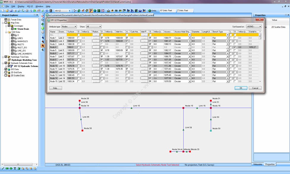
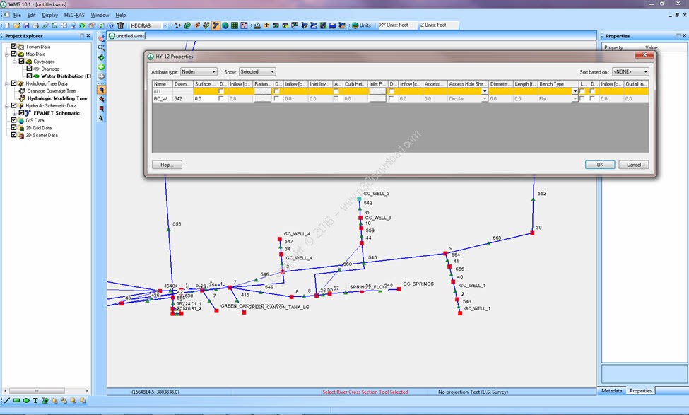
Storm drain modeling
– Draw a storm drain network or import a network from GIS
– Compute elevations, lengths, and slopes of pipes from underlyingelevation data
– Link the storm drain network to your hydrologic model data
– Export the hydrologic model data and the storm drain network toEPA-SWMM or XP-SWMM
– Import existing EPA-SWMM or XP-SWMM files into WMS
2D (Distributed) hydrology
– Flood forecasting (depth and velocity over entire 2D domain)
– Thunderstorm (localized rainfall) flood analysis
– Surface ponding and infiltration analysis
– Wetland modeling
– Land use change impact modeling
– Groundwater/surface-water interaction modeling
– Sediment and contaminant modeling
Installer Size: 1178 MB
Download Links : Aquaveo WMS v10.1.10 x64 + Crack